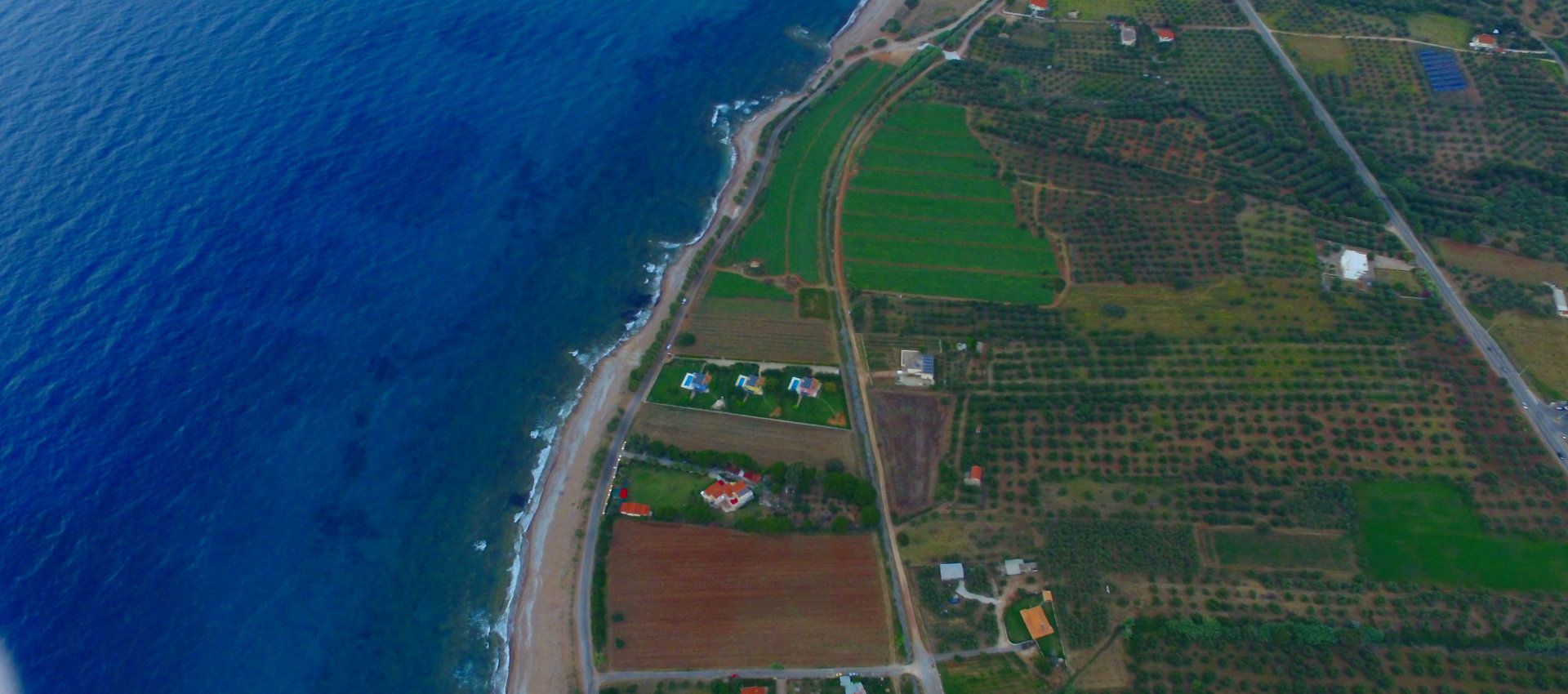
Kalo Nero: The beautiful village of Kalo Nero, located 5km north of Kyparissia in Messinia, lies on a superb stretch of sandy beach which extends for 63km to Katakolon. Every year, the Caretta-caretta turtles lay their eggs on this beach. There are many taverns, restaurants and cafes in Kalo Nero to satisfy all tastes.
 Voidokoilia (50km): Voidokoilia beach is probable the most famous beach in Messinia and one of the most beautiful in the Mediterranean. The name comes from the word “Voufras” which means “where oxen live”. It has also been referred to as Vouvota – Voidokoilia in an ancient inscription. Most obviously, the name may be derived from the large curve which the bay forms, reminding one of the belly of an ox. It is within a Natura 2000 protected area.
 Kyparissia: Kyparissia is the third largest city of Messinia after the capital Kalamata and Messine. It is built amphitheatrically and stretches from the foothills of Mount Aegaleo, known also as “Cold”, until the Ionian Sea. It is the capital of the municipality of Trifylia. Kyparissia has an excellent layout and all the amenities of a modern town. An agricultural and commercial centre, the town is divided into the Upper Town, which has been declared a traditional preserved settlement and the New (or Lower) Town, whose recently build settlement reaches the coast. In the Old Town, there are scattered historical monuments which testify to its history such as the Castle of Arcadia, Arcadia Square with its large plane tree and fountains at the castle’s entrance, the public baths (hamam) and cobble-stoned streets. The Lower Town is a modern settlement with few traditional elements.
 Neda Waterfalls (12km): The Neda River of Peloponesse is located on the border between the prefectures of Elis and Messinia. The river flows westwards from Mount Lykaion into the Ionian Sea between the gulf of Kyparissia and Zacharo. With a length of 32km, Neda is one of only two rivers in Greece bearing a female name, the other being the Erkyna River. A large part of the river crosses a ravine with very rich vegetation and along its length, waterfalls form, the largest being near Figalia with a height of approximately 50 metres.
 Lake Caiaphas (26,5km): The area of Lake Caiaphas is a unique ecosystem of unrivalled beauty. Located in the municipality of Zacharo, the lake stretches from the Ionian Sea with its extensive sandy coast, the wonderful pine forest of Strofylia, a lowland area which continues to the fields of Xirochori – Zacharo and the mythical Mount Lapitha, at the foot of which the Anigridon Nymphs spring lies to the west and the Gerani furrow spring to the east. The spas date back to mythical times. The ancient historian Pausanias mentions that the lake did not exist during his time, but only the Anigros River, which took its name from the cave of the Anigridon Nymphs. Our ancestors believed that nymphs resided in the large cave on the western side, one in fact being Kalliafeia, where the name “Caiaphas” comes from.
 Polylimnio (66km): Polylimnio is a cluster of several lakes found in the prefecture of Messinia, in the township Charavgi. The lakes Mafrilimna and Kefalovryso and the Kades Waterfall are the predominate feature among the large, sharp cliffs of the canyon. Its waters crash onto the lake’s surface from a height of 25 metres. The number of lakes in the region allows visitors to view remarkable scenery with ease as the local road leads them next to other lakes, namely Lakes Kades, ltalou, Stathoula to the left and Lake Mavrilimna to the right, the path of which leads to Lake Kades. Access to the township of Charavgi is easy as it is located between Pylos and Messine.